It's Not Too Late to Report Your
2026 Acreage.
Great news for MCGA members! You'll receive a 20% discount off the regular $250 report price at checkout.
Not an MCGA member? Join now!
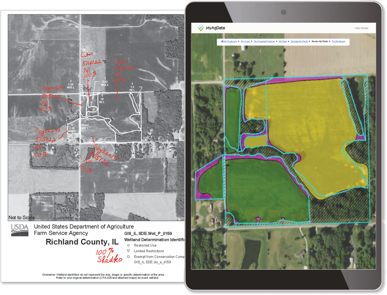
Get ready for big improvements in the convenience and accuracy of your annual acreage reporting with MyAgData FieldPortal.
Not an MCGA member? Join now!
Get ready for big improvements in the convenience and accuracy of your annual acreage reporting with MyAgData FieldPortal.

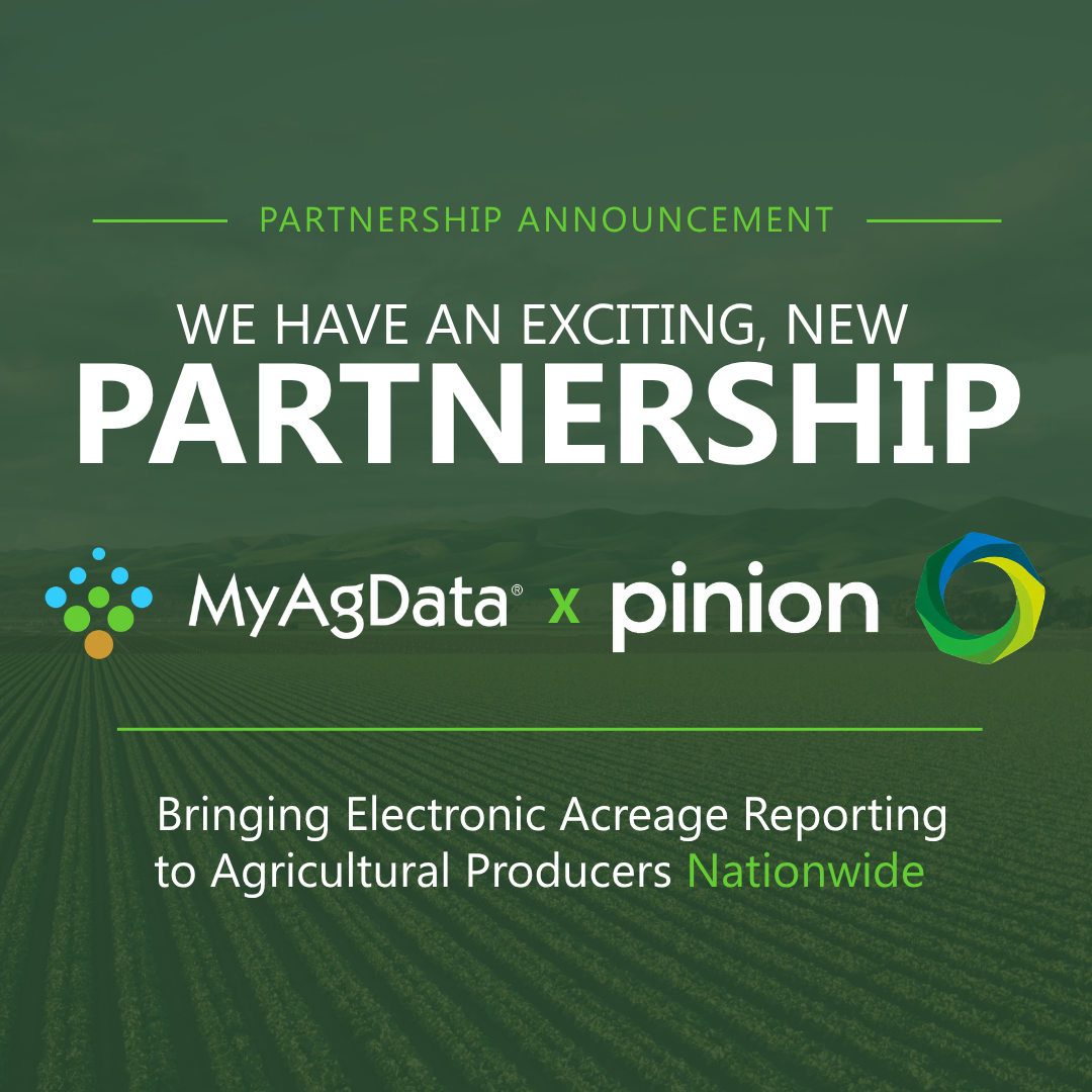
In partnership
Electronic Acreage Reporting
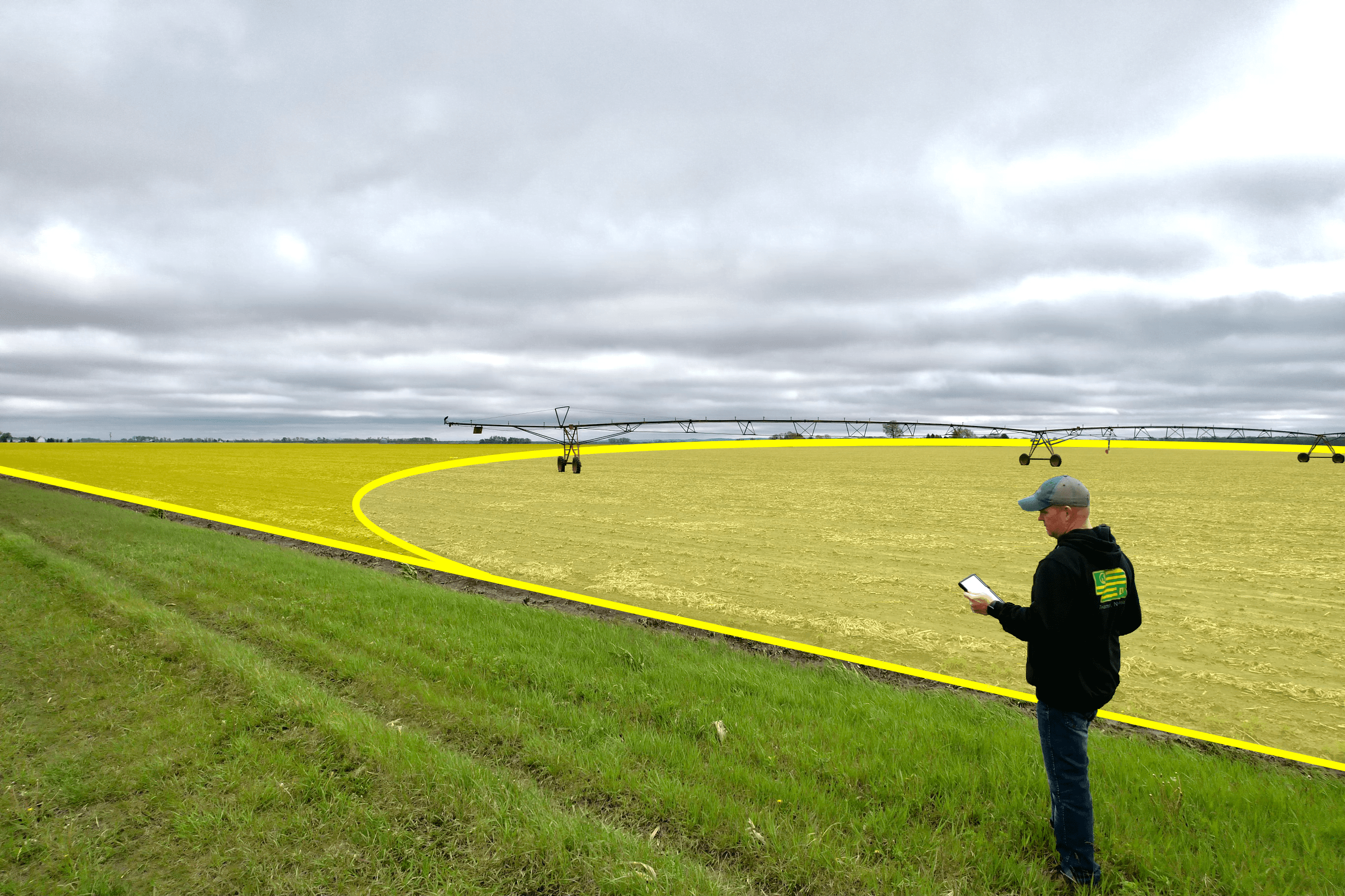
With MyAgData, you use the field data you already collect to create accurate, ready-to-file reports. We are already trusted by growers, agencies, and partners nationwide.
95%
Complete grower satisfaction with electronic acreage reporting
1m+
Acres reported through MyAgData
20+
Strategic partners across the ag industry
It's Time for Electronic Acreage Reporting

Save Time on Reporting
“After using MyAgData’s managed services and seeing how much less time I spent on reporting, I will never go back.”
- Grower, Bottineau County, ND
- Grower, Bottineau County, ND

Save Money & Increase APH
“Being able to break out my waterways and unplanted cropland in MyAgData by using my Deere data was a gamechanger for my reporting, I saved 5% on my premiums and increased my APH.”
-Grower, Fillmore County, MN
-Grower, Fillmore County, MN

Report the Way You Farm
“Certifying using MyAgData and my Climate data greatly increased the accuracy of my acres and was very easy on my end as a farmer.”
–Grower, Cass County, ND
–Grower, Cass County, ND

How Does it Work?
Simple & Transparent Pricing
Choose your data source, select your service level and we'll handle the rest!

CLU Boundary
Traditional CLU boundaries from FSA maps. Good for basic reporting needs.
FMIS Operational Boundaries
Use field boundaries from your farm management software (Climate Fieldview, John Deere Ops Center, etc...).
Precision Ag
Upload planting data from your monitor (Shapefile, GeoJSON, etc...).Most accurate method using your actual planted acres.
Manually Add Fields From a Map
Draw your fields directly on a digital map to create accurate acreage records when precision equipment data is not available.
Want to see how MyAgData can work for your operation?
Want to see how MyAgData can work for your operation?
Fill out the form below and we’ll show you how easy electronic acreage reporting can be.
Thank you! Your submission has been received!
Oops! Something went wrong while submitting the form.
In the News
Latest information about MyAgData
.png)
News
Insights
MyAgData and Pinion Partner to Bring Electronic Acreage Reporting to Agricultural Producers Nationwide
MyAgData and Pinion have partnered to expand access to electronic acreage reporting, helping agricultural producers simplify USDA compliance, reduce paperwork, and save time.

.png)
News
Insights
Farm Talk Podcast: Galesburg, North Dakota Grower Ben Bring on MyAgData
Galesburg, North Dakota grower Ben Bring was featured on the Farm Talk Podcast discussing his experience using MyAgData. He shares how the platform simplifies acreage reporting from the field to the office while saving time and reducing crop insurance costs.
.png)
News
Insights
MyAgData on Red River Farm Network: Acreage Reporting Accuracy
MyAgData CEO Michelle Tressel was interviewed on Red River Farm Network about how digital acreage reporting improves accuracy and efficiency by reducing manual entry and streamlining submissions to FSA and crop insurance providers.
.png)
News
Insights
MyAgData on Agriculture of America: Digital Acreage Reporting
MyAgData helps growers save time and reduce stress with digital acreage reporting. Featured on Agriculture of America, CEO Michelle Tressel explains how the platform’s verified system simplifies FSA reporting and streamlines compliance.